Copenhagen Metro Guide: Lines M1-M4, City Circle Line and How It Works
How does the Copenhagen Metro work?
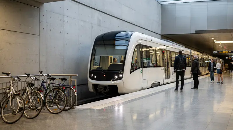
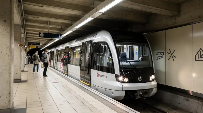
The Copenhagen Metro has 4 lines (M1, M2, M3, M4), is fully automated with no drivers, runs 24 hours a day every day of the year, and costs 24 DKK for a 2-zone single trip (most journeys within the city center). There are no turnstiles — you need a valid ticket before boarding. Getting caught without one is a 750 DKK fine.
Copenhagen’s Metro opened in 2002 and has been expanded three times since. It is a modern, automated, driverless system — one of a relatively small number in Europe. It runs on an honor-based ticketing system with no gates, which is both a convenience and a source of expensive mistakes for unprepared tourists.
This guide covers the four lines in practical detail: where they go, when they run, what they cost, and what trips you should realistically plan around them. For the full picture of all transport modes including cycling and buses, see getting around Copenhagen.
How the metro is built
The Copenhagen Metro is fully underground within the city center — the tunnels were bored beneath the existing street network in the early 2000s. The M1 and M2 lines emerge above ground in the Frederiksberg and Vanløse areas (western terminus), and the M2 runs above ground through Ørestad and toward the airport.
All four lines use the same rolling stock: small automated carriages, approximately 39 meters long per train. Compared to metros in London, Paris or New York, the carriages are noticeably smaller. During morning and evening rush hours on the M2 (airport line), carriages can be very crowded. The automated system cannot run longer trains — the platform lengths and system design are fixed. The metro compensates with high frequency.
Line M1 (green) — Vanløse to Amager
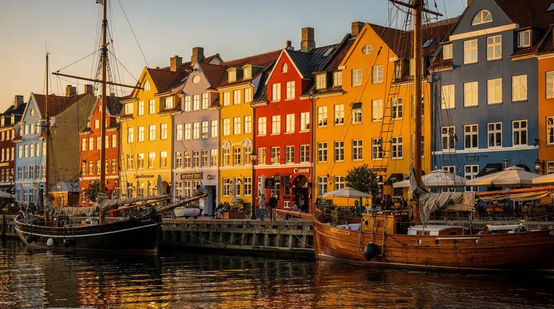
The M1 runs from Vanløse in the west through Frederiksberg, into the underground city center (Forum, Vanløse, Frederiksberg) and then via Nørreport and Kongens Nytorv to Christianshavn and Islands Brygge on Amager.
Key stations on M1:
| Station | What’s there | |---|---| | Vanløse | Western terminus; S-tog connection to suburbs | | Flintholm | S-tog interchange; Frederiksberg | | Frederiksberg | Near Frederiksberg Have (park) and Frederiksberg Palace | | Forum | Near the Forum concert venue; Frederiksberg center | | Nørreport | Central interchange: M1/M2/M3 + S-tog; Torvehallerne market, Rosenborg | | Kongens Nytorv | Major interchange M1/M2/M3; Nyhavn 5 min on foot | | Christianshavn | Christiania 10 min walk; canal area | | Islands Brygge | Harbour baths in summer; residential southern Amager | | Sundby, Bella Center | Conference area; not tourist-relevant | | Vestamager | End of M1; Amager nature reserve |
The M1 is useful for reaching Frederiksberg (accommodation, Frederiksberg Have), the city center (Nørreport, Kongens Nytorv), Christianshavn, and the residential areas of Amager.
Line M2 (yellow) — Vanløse to Copenhagen Airport
The M2 shares the same route as M1 from Vanløse to Christianshavn, then branches south through Ørestad (a modern development zone) and out to Copenhagen Airport.
The branch section (Christianshavn to Airport):
| Station | What’s there | |---|---| | Christianshavn | (same as M1) | | Kongens Nytorv | (same interchange as M1) | | DR Byen | Danmarks Radio broadcast center; not tourist-relevant | | Islands Brygge | (same as M1 — M1 and M2 share this station) | | Sundby | Residential | | Bella Center | Copenhagen Congress Center | | Ørestad | Business district; housing; Fields shopping center | | Copenhagen Airport | Direct connection to Terminal 3 arrivals/departures |
M2 is the airport line. You do not need to change trains — take M2 from any station on the shared M1/M2 route and you arrive at the airport. From Kongens Nytorv: 12 minutes. From Nørreport: 14–16 minutes.
The M2 also serves Ørestad, which is a large modern development area built primarily to fund the metro construction. It has some large housing blocks, the Fields shopping center (Scandinavia’s largest), and little of tourist interest. Do not accidentally travel past the airport.
Line M3 (red) — City Circle Line (Cityringen)
The M3 is a full loop — 15.5 km, 17 stations, opened September 2019 after years of delay and major cost overruns (final cost approximately 24 billion DKK). The circle runs entirely underground and connects neighborhoods that were previously without direct metro access.
The full M3 circuit (direction: clockwise, Copenhagen Central Station → Frederiksberg):
| Station | Neighborhood | What’s there | |---|---|---| | København H | Central Station | Tivoli, Central Station (DSB), Vesterbro start | | Rådhuspladsen | City Hall Square | City Hall, start of Strøget | | Gammel Strand | Indre By south | Near National Museum, Christiansborg | | Kongens Nytorv | Nyhavn area | M1/M2/M3 major interchange | | Marmorkirken | Frederiksstaden | Marble Church; Amalienborg Palace nearby | | Østerport | Østerbro/Østerport | DSB S-tog interchange; near Kastellet fortress | | Trianglen | Østerbro | Residential neighborhood center | | Poul Henningsens Plads | Østerbro | | | Vibenshus Runddel | Ydre Østerbro | | | Skjolds Plads | Nørrebro | | | Nørrebro St. | Nørrebro | Nørrebro neighborhood center; Assistens Cemetery | | Nørreport | Center north | M1/M2/M3 + S-tog; busiest interchange | | Frederiksberg Allé | Vesterbro/Frederiksberg | | | Enghave Plads | Vesterbro | Vesterbro neighborhood center | | Sydhavn | Southern harbor | M3/M4 interchange | | Carlsberg | Carlsberg area | Carlsberg brewery district | | Vanløse | Western suburbs | M1/M2/M3 interchange | | Frederiksberg | Frederiksberg | M1/M2 + M3 interchange |
Completing the full circle takes approximately 24 minutes. In practice, you choose a direction (toward Kongens Nytorv or toward København H) based on the shorter arc to your destination.
The City Circle Line is the most useful addition to the metro for tourists staying in Vesterbro, Nørrebro, Østerbro or Frederiksberg — neighborhoods that previously required buses or long metro combinations.
Line M4 (blue) — Sydhavn Line and Orientkaj branch
The M4 is the newest line, opened in phases from 2020. It branches from Kongens Nytorv toward the southern harbor (Sydhavn) and from Østerport toward Orientkaj (the eastern harbor development area).
M4 Sydhavn branch (from Kongens Nytorv):
- København H (Central Station) — also the departure point for trains to Malmö
- Enghave Brygge (southern harbor waterfront)
- Sydhavn (connects to M3)
M4 Orientkaj branch (from Østerport direction):
- Nordhavn (northern harbor development)
- Orientkaj (end of this branch)
The M4 primarily serves new residential developments and the harbor areas. For tourists, its most practical use is access to Nordhavn (northern harbor — some restaurants and galleries) and the connection between Kongens Nytorv and the Central Station without using the M3 full arc.
Key interchange stations in detail
Nørreport
The busiest station in the entire Copenhagen transit network. Here the M1, M2, and M3 all stop, plus the S-tog suburban rail lines connect at the adjacent Nørreport S-tog station (a short walk, well-signposted).
Above ground: Torvehallerne covered market (60 stalls — the best quick food market in the city), Rosenborg Castle 8 minutes on foot, the lakes and green areas of Ørstedsparken.
If you are lost in Copenhagen transit, going to Nørreport and starting again is always a reasonable approach.
Kongens Nytorv
The second-busiest interchange. M1, M2, and M3 all stop here. Nyhavn is a 5-minute walk east. The Royal Theatre (Det Kongelige Teater) is on the square. This is also where you change between the airport M2 and the City Circle M3.
Vanløse
The western terminus of M1 and M2. S-tog connections to the outer suburbs. Less relevant for most tourists but useful if staying in Frederiksberg outer areas or Vanløse.
København H (Central Station)
On the M3 and M4. Also the main DSB intercity and regional train hub — for day trips to Helsingør, Roskilde, Odense, Aarhus. Tivoli is directly across the road. The S-tog connects from this station to the inner suburban rail network.
Ticketing: what you need to know before boarding
The Copenhagen Metro operates on the honor system. There are no turnstiles, no barriers. You step directly onto the platform and board the train. The requirement is that you have a valid, timestamped ticket before boarding — not before the train arrives, but before you step onto the train.
What counts as valid:
- A ticket purchased from a DOT machine with a timestamp from within the last 75 minutes (2-zone) or 90 minutes (3-zone)
- A ticket in the DOT Tickets app that has been activated (not just bought — you must press “Start” or equivalent)
- A Rejsekort card that has been tapped on the yellow reader at the station entrance
What happens when inspectors arrive: Inspectors — both uniformed and plainclothes — board trains, often in groups of 3–4. They check every passenger. The fine is 750 DKK, payable by card on the spot or invoiced to an address. EU travelers can be traced via passport/ID; non-EU travelers are often required to pay immediately. The inspectors are not aggressive but they are consistent and the fine is not negotiable.
Practical advice: Buy your ticket when you think about it — as you enter the station, from the DOT app on your phone, or from the machine on the platform. Never board intending to buy “later.”
Metro times and frequency
| Time period | Frequency | |---|---| | Peak (07:00–09:00, 15:30–18:30) | Every 2–4 minutes | | Daytime off-peak | Every 4–6 minutes | | Evening (20:00–midnight) | Every 6–8 minutes | | Night (midnight–05:00) | Every 7–10 minutes |
There is no schedule to memorize. Arrival time boards at each station show the next 2–3 departures for each direction.
Metro map and wayfinding
Each station has large, clear diagrams of the full network. The color coding (green M1, yellow M2, red M3, blue M4) is consistent across all signage. Direction of travel is indicated by the terminal station name: M2 toward “Airport” or toward “Vanløse,” M3 toward “Østerport” or “Frederiksberg.”
The metro is not complex to navigate — most tourist journeys involve one line (the M2 from the airport to the center, or the M3 for the circular neighborhoods). Transfers at Kongens Nytorv and Nørreport are well-signed.
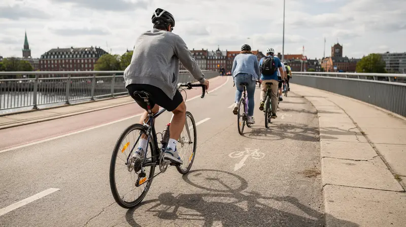
The metro and cycling
You can bring a bicycle on the metro, but with restrictions: full-size bicycles are not permitted during peak hours (07:00–09:00 and 15:30–18:30) on weekdays. Outside those times, bikes can be brought into the designated carriage area (end of the train). The carriages are small — if it is busy, bikes are difficult to maneuver. Folding bikes are permitted at all times.
For carrying a regular bike, the S-tog is generally more comfortable.
Frequently asked questions about the Copenhagen Metro
Can I use the metro all night?
Yes. The metro runs 24 hours a day, 7 days a week. Late-night frequencies (midnight to 05:00) are around every 7–10 minutes. This is the primary reason to choose accommodation on a metro line if you plan to be out late — no need to arrange a taxi or wait for a night bus. See where to stay in Copenhagen for neighborhoods closest to the metro.
Is the metro safe?
Copenhagen’s metro is among the safest in Europe. The city has low violent crime, and the metro’s automated operation means there are no driver areas or isolated sections. Cameras monitor all stations and carriages. Late-night travel is normal and not a safety concern. Standard urban sensibility applies — keep an eye on your phone and bag, as you would anywhere.
Why are the metro carriages so small?
The original M1 and M2 were designed with short tunnels based on demand projections from the late 1990s. The automated system and tunnel diameter limit the ability to run longer trains. The M3 (City Circle Line) was designed with the same infrastructure. The result is frequent trains but limited capacity per train — the right trade-off for a city of 800,000.
Is there a metro app?
The DOT Tickets app is the official ticketing app. For journey planning, use Rejseplanen (rejseplanen.dk or the Rejseplanen app) — it combines metro, S-tog, bus and regional trains into a single planner and is more accurate than Google Maps for Copenhagen.
What is Cityringen?
Cityringen is the Danish name for the M3 City Circle Line. It translates as “City Ring.” It was opened in September 2019 after years of construction that disrupted central Copenhagen’s streets. The cost (approximately 24 billion DKK) was covered by a combination of central government funding and land sales in the Ørestad development zone that was created partly to fund the original metro.
Can I pay with cash on the metro?
Some ticket machines accept Danish kroner cash (coins and notes). However, card payment is universally accepted and more reliable. The DOT Tickets app accepts major bank and credit cards. Having DKK cash for the metro is not necessary.
How is the Copenhagen Metro different from the S-tog?
The Metro (M1–M4) is automated, underground, runs 24/7 and serves the city center and inner neighborhoods. The S-tog is above-ground suburban rail, operated by DSB staff, runs 05:00–01:00, and serves outer suburbs and day-trip destinations (Helsingør direction, Roskilde direction, Klampenborg/Dyrehaven). They use the same zone ticketing but are operated by different companies (Metro by the Copenhagen Metro company; S-tog by DSB).
Frequently asked questions — Copenhagen Metro Guide: Lines M1-M4, City Circle Line and How It Works
What are the Copenhagen Metro lines?
M1 (green) runs from Vanløse through Frederiksberg, Nørreport and Kongens Nytorv to Amager. M2 (yellow) shares the same route but branches at Christianshavn toward Ørestad and Copenhagen Airport. M3 (red) is the City Circle Line, a full loop through central neighborhoods opened in 2019. M4 (blue) is the newest line serving the southern harbor (Sydhavn) from Kongens Nytorv via Copenhagen Central Station.How often do Copenhagen Metro trains run?
Every 2–4 minutes during peak hours (07:00–09:00 and 15:30–18:30). Every 4–6 minutes in off-peak daytime hours. Every 7–10 minutes overnight (midnight to 05:00). The metro runs 24 hours a day, 365 days a year — no schedule to memorize, just arrive and wait.How much does the Copenhagen Metro cost?
A single 2-zone ticket (covering most city center journeys) costs 24 DKK (approximately 3.20€). A 3-zone ticket (required for the airport) costs 36 DKK. A 24-hour unlimited ticket for all zones costs 130 DKK. Buy via the DOT Tickets app, from yellow machines at stations, or use the Rejsekort card for 30-40% cheaper per-trip fares.What is the City Circle Line (Cityringen)?
Cityringen is the M3 line — a 15.5 km circular route with 17 stations opened in 2019. It connects neighborhoods that were previously poorly linked to the metro: Nørrebro, Bispebjerg, Vanløse, Frederiksberg, Enghave Plads, Kongens Nytorv and Nørreport. The entire circle takes about 24 minutes. It is the most significant expansion of the network and the line that most improved access to residential neighborhoods.Is the Copenhagen Metro accessible?
Yes. All metro stations have lifts from street level to platform. The carriages are step-free from the platform (no gap). Tactile paving on platforms guides visually impaired passengers. Spaces for wheelchairs, prams and bikes are available in each carriage. Audio and visual announcements operate in Danish and English.Does the Copenhagen Metro run all night?
Yes. The metro is the only Copenhagen transit mode that runs 24/7. The S-tog (suburban rail) stops around 01:00 and night buses supplement the network. If you are returning late from Nyhavn, Vesterbro or Nørrebro and your hotel is on a metro line, the metro is your most reliable option.What is the fine for not having a metro ticket in Copenhagen?
750 DKK (approximately 100€). This is non-negotiable and issued immediately by uniformed or plainclothes ticket inspectors who board trains unannounced. The metro has no turnstiles — the honor system relies on inspections. Inspectors target the airport line and tourist-heavy routes. Always buy a ticket before boarding.